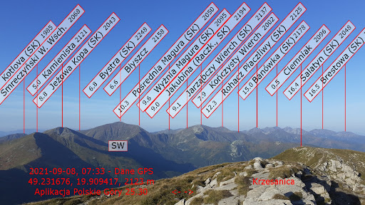
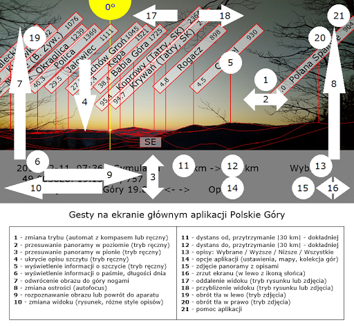
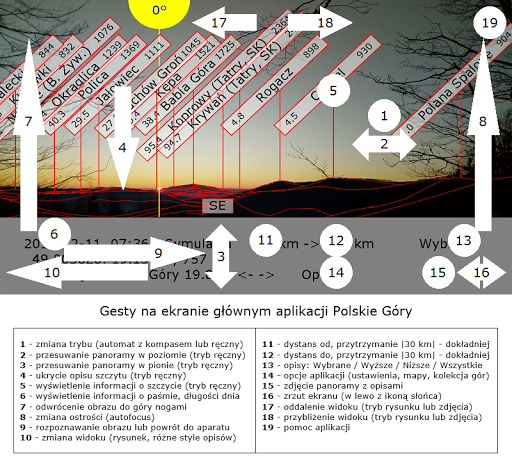
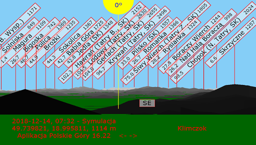
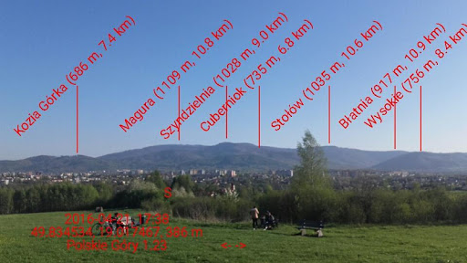
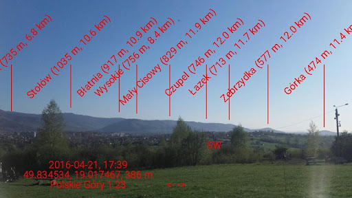
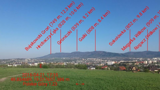
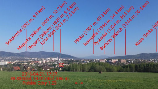
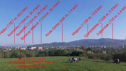
Before installing the application, please watch the movie (you can without sound - it is with subtitles).
More info on page:
http://polskiegory.byledobiec.pl
Polish Mountains - 7 benefits for you:
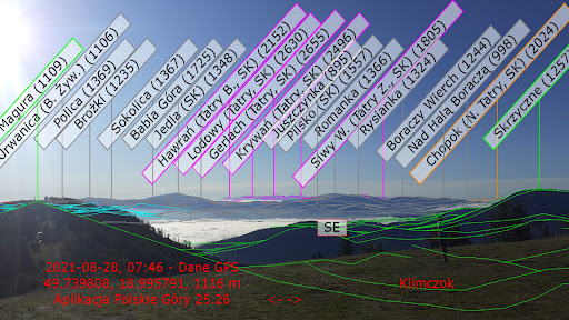
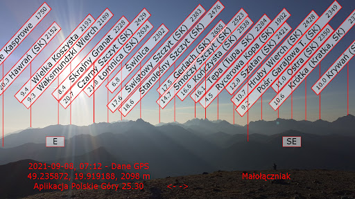
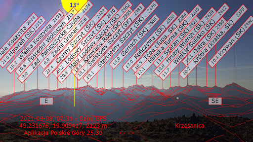
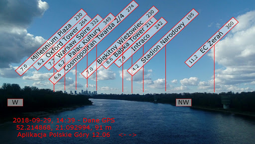
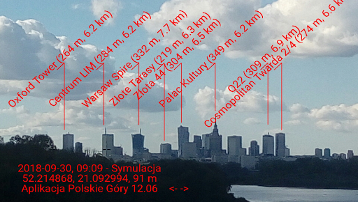
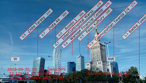
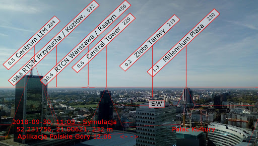
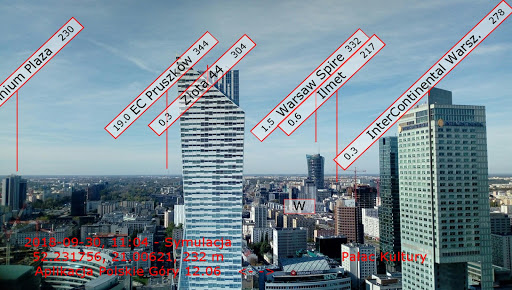
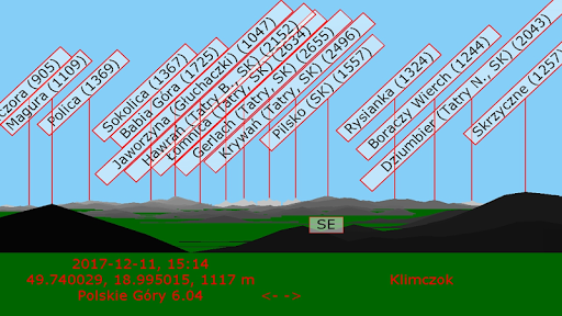
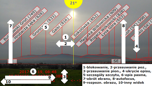
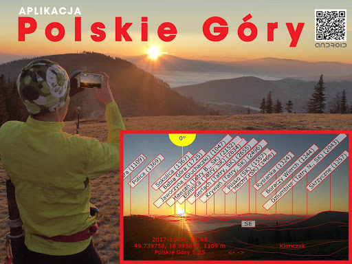
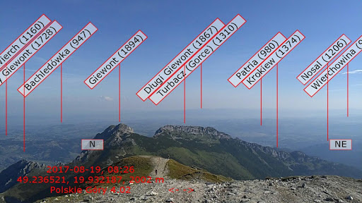
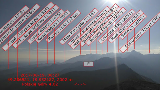
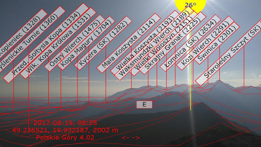
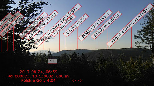
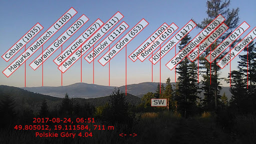
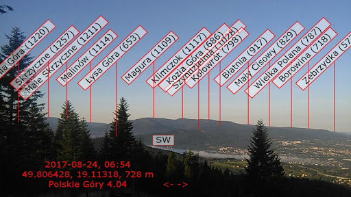
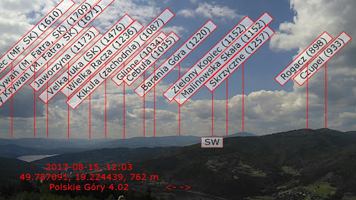
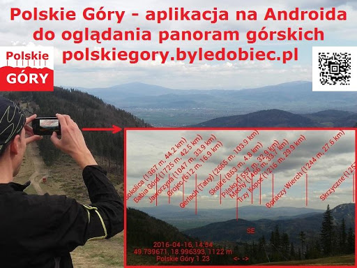
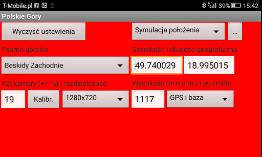
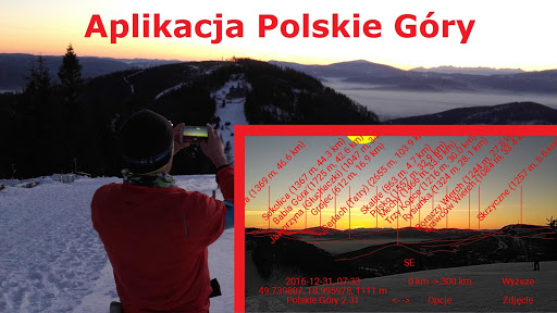
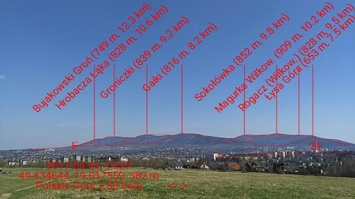
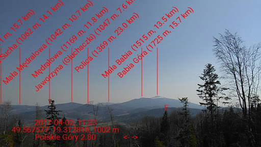
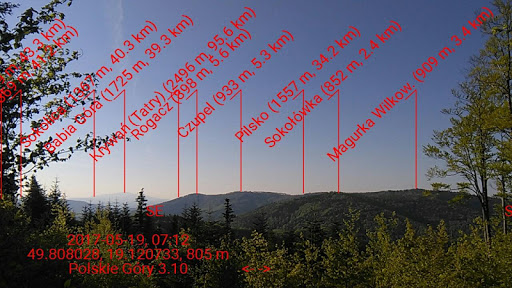
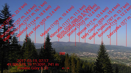
1. You will see on your phone a virtual panorama of the mountains with descriptions of the names of the peaks, altitude and distance to them,
2. The description of the mountains will automatically move as the phone rotates,
3. You will take and share photos of mountain panoramas with descriptions,
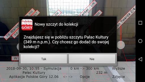
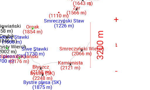
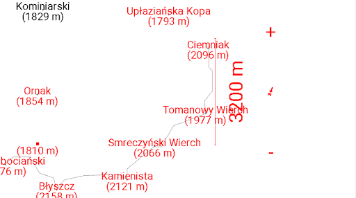
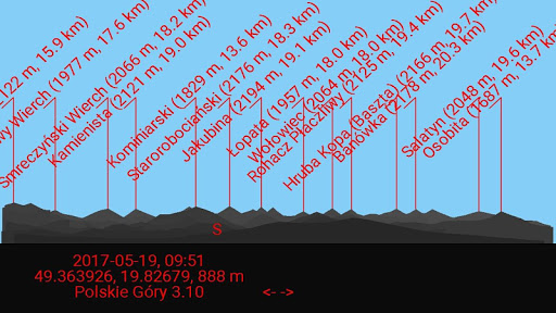
4. You will see the drawn mountain panorama from a given place in a given direction,
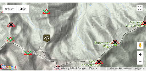
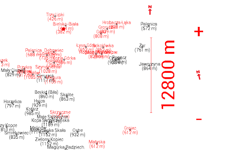
5. Check your location on maps with marked peaks,
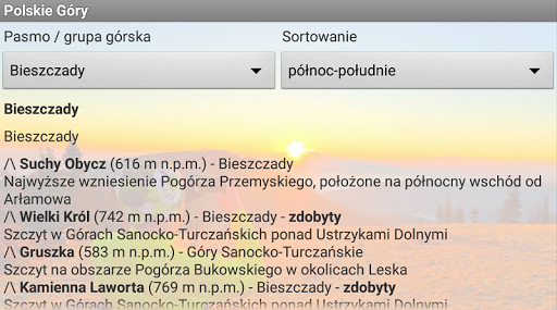
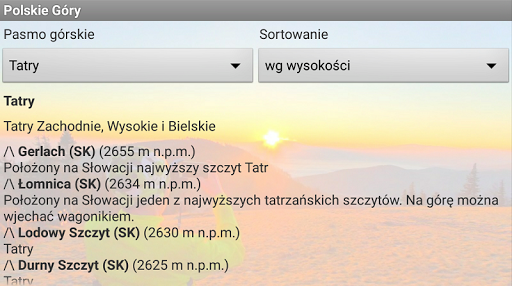
6. You will read information about Polish mountains and use the interactive map of the bands,
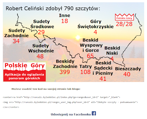
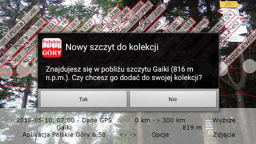
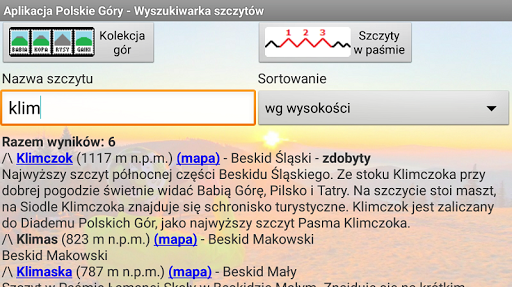
7. You will collect the peaks you have earned.
The Polish Mountains application is used to describe peaks in augmented reality and includes a module that allows you to collect the peaks you have acquired. It uses technologies such as: Augmented Reality (AR), Image Recognition (IR) and Artificial Intelligence (AI).
The advantage of the Polish Mountains application is that the entire peak base and terrain topography are included in the installation package, so you don't need to download additional data.
Land cover is sufficient for mountain tourists in Poland: Tatra Mountains, Sudetes, Beskids, and Świętokrzyskie Mountains. The application also describes hills throughout Poland, tall buildings in Polish cities, chimneys, masts, and on the coast means e.g. lighthouses. The maps describe mountain lakes and ponds, e.g. Morskie Oko. The mountain area in the Sudetes covers from the west: Lusatian Mountains and Foothills, Jizera Mountains, Karkonosze, Rudawy Janowickie, Kaczawskie Mountains and Foothills, Kamienne Mountains, Wałbrzyskie Mountains, Sowie Mountains, Ślęży Massif, Table Mountains, Orlickie Mountains, Bystrzyckie Mountains, Śnieżnik Massif, Bialskie Mountains, Złote Mountains, Bardzkie Mountains, Opawskie Mountains and the Czech Jeseníky massif which belong to the Czech Republic entirely. Many Czech peaks are added in the bands mentioned above. In the Beskids, land cover starts with the Czech Silesian-Moravian Beskids, then: Beskid Śląski, Żywiec Beskids (with the Babia Góra massif), Beskid Mały, Beskid Makowski, Beskid Wyspowy, Gorce, Beskid Sądecki, Beskid Niski, Bieszczady. From other Carpathian ranges, the description covers the Pieniny and Tatra Mountains (also the entire Slovak part) and the most important Slovak peaks from the visible ranges in the border areas: Little Fatra, Big Fatra, Great Chocz, and Low Tatras. Land cover also includes the Ukrainian Carpathians, and even mountains in Romania, which in good weather are visible from Tarnica.
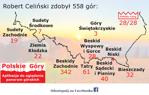
The Polish Mountains application is recommended for PTTK guides and applicants for Mountain Tourist Badges (GOT).
The application will work in all cities located in the mountains, such as: Świerardów Zdrój, Jakuszyce, Szklarska Poręba, Karpacz, Kowary, Jelenia Góra, Kamienna Góra, Boguszów-Gorce, Lubawka, Wałbrzych, Bielawa, Srebrna Góra, Bardo, Sobótka, Jedlina Zdrój , Nowa Ruda, Radków, Kudowa Zdrój, Duszniki Zdrój, Polanica Zdrój, Kłodzko, Bystrzyca Kłodzka, Międzygórze, Lądek Zdrój, Stronie Śląskie, Cieszyn, Skoczów, Ustroń, Wisła, Istebna, Koniaków, Jaworzynka, Bielsko-Biała, Szczyrk, Brenna, Porąbka, Międzybrodzie, Kocierz, Żywiec, Węgierska Górka, Milówka, Rajcza, Ujsoły, Glinka, Rycerka, Zwardoń, Jeleśnia, Korbielów, Zawoja, Kęty, Andrychów, Wadowice, Sucha Beskidzka, Maków Podhalański, Myślenice, Rabka Zdrój, Nowy Targ, Chochołów , Witów, Kiry, Kościelisko, Zakopane, Murzasichle, Małe Ciche, Białka Tatrzańska, Bukowina Tatrzańska, Łapsze, Mszana, Limanowa, Niedzica, Czorsztyn, Ochotnica, Krościenko, Szczawnica, Nowy Sącz, Rytro, Piwniczna Zdrój, Krynica Zdrój, Muszyna, Tylicz, Wysowa Zdrój, Gorlice, Jasło, Krosno, Ustrzyki, Solina, Polańczyk, and Cisna. Mountain collectors have at their disposal all the peaks covered by the badges: Crown of Polish Mountains, Diadem of Polish Mountains, Crown of Polish Sudetes and Crown of Sudetes.
Reduced ANR errors in the main application thread by asynchronously sending statistics
Fixed data download about height from photo properties - correction for a more precise undulation value
Error handling when downloading peak database.
Improved the encryption mechanism
Changed the mechanism of downloading the database of peaks and topography to make it work more efficiently, the download progress was visible and ANR errors did not occur.
Advertisements Google AdMob
Updated the location and description of the northern peak of Nowy Wierch in the Slovak Belianske Tatras.
Updated description of Kozi Wierch
Update of peaks in the Low Beskids, south of Nowy Żmigród
Updating peaks in Pieniny Spiskie
Updating descriptions of the peaks near the Dukielska Pass in Beskid Niski
Update of information about the application and privacy policy
Support for exceptions in the mechanism of coloring peak descriptions, update of descriptions of Gomulnik Mały, Kozia Góra and Magura (board on Chata na Groniu
Protection against a strange error in isKoronaGorPolski(), generating descriptions in 12 different colors (previously in 8).
Updating the description of Ślęża and Góra Święty Anna
Updated the description of Modynia and Skiłki in Beskid Wyspowy with information about lookout towers
Addition of the Javorske peak in the Slovak Kysuckie Beskids
Updating the location of Valentine's Hill
Update of the name and description of the Orło (Orzeł) summit in the Żywiec Beskids
Determining the horizon line and estimating the current height based on topographic data from Poland
Update of the names and descriptions of the peaks in the Tatra Mountains
Update of the peaks above Szczawnica
Update of the location of the Czupla peak over Straconka in the Little Beskids.
Addition of Slovak peaks in bands 8 and 9, addition of Grabarka and Elewator in Bartoszyce in band 11
Date simulation fix in settings, especially for February
Update of the peaks in the Wałbrzyskie Mountains, near Jedlina-Zdrój.
Adding peaks in Roztocze and in Łagowskie Lake District.
Adding hills in Poland, mainly the peaks of the Crown of Wielkopolska
Default no GPS altitude correction in the settings, message about no correction
Dodanie Wzgórze Gedymina in Góry Wałbrzyskie, updating the description of the Piorun summit in Low Beskids
Adding peaks in the vicinity of Grybów in Beskid Niski
Update of the peaks in Beskid Mały south of Ponikwia
Correction when switching the option "Lecę tam"
Addition of Gromnik - the highest elevation of the Strzelińskie Hills
Minor correction on the map when unlocking the phone after a longer inactivity
Minor modifications in the database of peaks: around Głuchołazy, description of Potaczkowa in Gorce, Kapliczne Wzgórze in Świętno
Adjustment of the application to Android in version 10
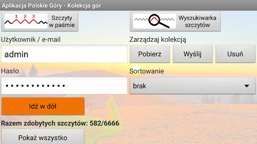
Marking the peaks of the Crown of Polish Mountains in the collection, longer list of years in the settings and loading the current date for simulation, updating the height and description of Rysy and Śnieżka , update information in support
Adding an alternative name of the Lusatian Mountains - Zittau Mountains
Message about the possibility of switching bandwidth
Drawing an area definitely below the horizon
Updating the description of Brzanka and adding Kokocz and Furmaniec Zach. in the Ciężkowice Foothills, as well as the update of the height of the Pass under the Równia in the description of Kozia Góra
Updating the descriptions of the peaks in the north-eastern part of the Silesian Beskids.
Commemorating Spajka, updating the description of Magura in the Silesian Beskids and Krzemieniec in the Bieszczady Mountains.
Wełczoń (Patria) Updated description of Mounds with Polana Rękki
Kopa Radziechowska (Wapiennik) in the Silesian Beskid
Adding skyscraper View Towers in Warsaw
Przykiec - Przykrzec (alternative name), adding descriptions smaller hills in the Western Beskidy
Adding 4 skyscrapers to the base in Warsaw, including Varso
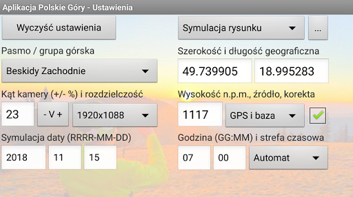
Possibility to simulate the position on the observation decks of selected buildings (for now the Palace of Culture in Warsaw)
Application help update
Adding Magurka Wiślańska in band 6
Updated location and description of Jagodna in the Bystrzyckie Mountains after placing the observation tower on this peak
Minor corrections when going to the help screen, switching views between drawing and camera and updating information in help
Big Destna lookout tower, update of Baldness description
Adding buses and Stebnicki Magura to band No. 7
protection reported for errors on some devices
supplement additional peaks The Carpathians within the band 4 - Western Beskidy
Repair strange error unexpected shutdown of applications for bandwidth whole Poland - the problem of determining the shape of the object when drawing
Adding RON Malczewski in Krakow
Updated description of Eliaszówka (lookout tower, trails), adding two towers of The Warsaw Hub in Warsaw
Enabling a comfortable transition from the Drawing mode to the Camera mode by swiping to the right in the lower left corner of the main screen
Update peaks in the Western Beskidy : Palenica nad Szczyrk i Micherda
Amendment behavior angle camera when switching screens
Adding peaks of the Beskidy Mountains in the Western band All Poland
Adding objects Tri-City and the surrounding area
Update peaks in the Beskid Sadecki and Makowski
Update of the peaks in the Bukowski Gron massif in the Little Beskids
Update of peaks in the Beskid Mały: Dybkowa, Maleckie, Cisowa Grapa
Addition of an alternative name for Riabej Rock - Rabia Skała and the Pricny vrch summit - Góra Poprzeczna
Update of peaks in the Western Beskids - Cuberniok, Zasolnica, Kozubnik
Adding Skoruszowa Turnia in the Tatra Mountains in Slovakia, updating descriptions of peaks in the Western Beskids
Addition of four chimneys in Silesia
Update of peaks in the Slovak West Tatras
Update of the peaks in the Silesian Beskids
Updating help for information about recent changes in the application
Improvement of the message with blocked direction - no display in the mode of On-going and Clock, update of peaks in the Western Sudetes
Limiting ads and information about the need to calibrate the compass
Update of the peaks in the Beskid Makowski near Skomielna Czarna
Clock mode, application customization for API 28 (Android 9.0), error correction ERR_CLEARTEXT_NOT_PERMITTED when redirecting to panorama udeuscle on Android 8 phones and higher
The addition of peaks in the Kysucké Mountains in Slovakia
Adding hills over Kazimierz Dolny on the Vistula, updating peaks in band 1
Update of the peaks in the Western Sudetes
Update of the peaks in the Massif Łysiny in the Beskid Mały
Refinement of the privacy policy (for which application rights are needed), update of peaks in band 1
Update peaks at the limits of bands 1 and 2
The addition of Barania Góra over Skorzeszyce in the Świętokrzyskie Mountains
Adding peaks to the band No. 7 in Łapsze Niżne and its surroundings
The addition of peaks to the east of Lake Solina
Update of the peaks of the Łomnicki Hills
Update of peaks at the border of Beskid Mały and Makowski, addition of KGP peaks for other bands: Chełmiec in band 3, Rysy in band 4
Support in devices without GPS module, new advertisement message, adding peaks in the Opawskie Mountains
Updating peaks in band number 3, lookout tower at the top of Barana in the Low Beskids
Updating the location of Równia in the Silesian Beskid and three hills in Górki Wielkie
Improving the functionality of describing photos, adding peaks to the Kaczawskie Foothills
Photo mode in settings - the ability to describe previous photos
Supplementing the Bieszczady mountains in the Low Beskid range
Small modifications at the base of the peaks: change of the location and height of the Northern Jagodna in the Bystrzyckie Mountains, change of the Kończysta height in the Tatras
Taking into account refraction in determining the effect of Earth's sphericity on hiding peaks beyond the horizon
Patch correction in the advertisement display message
Disable horizon detection when changing view
Adding the sun and shadow lines on the map
Changes in determining the default line length of the descriptions and the precision of the recorded direction
Removing the problem with hiding the peaks on the map
Visibility corner on the map, performance improvements, removing the problem of hiding peaks when zooming
Update of peaks on Połoninie Wetlińska
Refreshing descriptions in the zoom option
Adding peaks to the Dynów, Przemyśl and Bukowski foothills, above all on the boundaries of bands 8 and 9
Supplementing the base of the peaks, mainly in the Dynów Foothills
Adding a message on the Collection screen with the possibility of registration on the RunCalc portal
Adding Tatra peaks in band number 7
Small corrections at the summit base in Beskid Sądecki
The lookout tower on Dzikowiec, precise location of the peak of Babia Góra and Barania Góra
Handling an error when switching to photo galleries on some devices
Wielki and Mały Koziniec in the Silesian-Moravian Beskids
Small changes in the base of peaks
Additional information about drawing approximation
Updating the base of the peaks, mainly in the Sanocko-Turczańskie Mountains and the Przemyśl Foothills
Update of the base of the peaks in the vicinity of Boguszów-Gorce and in the Ukrainian Bieszczady
Switching the view to the drawing, performance improvements
Repairing the problem on Samsung Galaxy XCover4 - strange data returned by the compass
Correct switching of screens in the absence of a location
Changing the position of the Rogaczki Wilaczicki, explaining the problem with the angle of view range given by the device
Gyroscope support, changes in NMT data retrieval
Change of the numerical terrain model to SRTM
Minor changes in the description of the Trójgarba in the Wałbrzyskie Mountains (construction of the observation tower), a new picture of the author
Adding peaks in band 6, the correction of passing the default band on the Mountains Collection and Peak Browser screens
The default option Selected when presenting peaks on a panorama
Block Google altitude download options for regular users
Update of information about the observation tower on Włodzicka Góra and Druciak on the slopes of Rogacz Wilkowicki
Update of the peaks near Szklarska Poręba
Error handling OutOfMemoryError when using the camera, updating the position and description of the turnstile and Magura in the Silesian Beskid
Limiting the height value to 9999 m
Adding peaks to the Lusatian Foothills
Adding peaks in the western part of the Western Sudetes
Amendments when updating the sun's position, adding information in the help
Adding the tops of the Polish crown (the highest in individual provinces), minor corrections
Update of peaks in the Tatras, change of some descriptions, including Sokolica in the Pieniny Mountains, after damage to the pine at the top by a rescue helicopter :-(
Supplementing the Tatra peaks for bands 6 and 7, minor corrections
Numbering of peaks within crowns
Addition of information on the Diadem of the Polish Mountains, the Crowns of the Polish Sudetes and the Crown of the Sudetes
Setting the default line length in manual mode, improving the description of the Ostredok summit in Veľká Fatra, information about the author on the help screen
Addition of two Wheeled Turni in the High Tatras
Short message about activity or turning off the compass, adding Prosieczny in the Choczańskie Mountains, changing the location of the LIM Center
Corrections when switching the distance range to the described peaks after changes made by the user
Small fixes - adding a question mark in the question about adding a peak to the collection, improving the name of the Velky Kozinec summit
Change of the name of the third band to "Ziemia Kłodzka", update of the summits in the Sudeten Mountains - ranges according to regionalization, Crown of the Polish Sudetes
Allowing adding to the collection the peaks from the 11 - City of Poland, completing peaks in the Central Sudetes
Supplementing the base in band 6 - adding peaks to the Beskid Makowski, copying peaks from the Mały and Śląski Beskids
Improving performance when hiding further peaks through the ridges of the closer mountains
Minor updates and corrections at the base of summits
Corrections of the mechanism for checking permissions on the start screen
Supplementing the base of peaks in the Sudeten Foreland, minor corrections in the Western Beskids
Update of the base of peaks in the Central Sudetes - Wzgórza Włodzickie
Update of peaks in the Western Tatras, correction of the Baraniec in the Kaczawskie Mountains
Updating the base of the peaks, mainly in the High Tatras
Supplementing the base of the peaks, mainly in the Spisko-Gubałowski Foothills and on the boundaries of the bands 5, 6 and 7, information on the number of peaks on the Bandwidth screen
Improvement of the mechanism for describing visible peaks, updating the base of peaks in the Silesian and Silesian-Silesian Beskids
Update of the summit base in the Beskid Wyspowy
Updating the base of peaks in the Makowski and Mały Beskids
Updating the base of peaks in the Silesian Beskids
Updating the base of peaks in the Beskid Niski and Bieszczady mountains
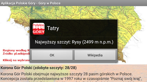
Adding links to Wikipedia for bands and peaks on the screen of the Crown of Polish Mountains
Updating descriptions of the mountains, mainly in the Sudetes and peaks belonging to the Crown of Polish Mountains
The addition of peaks in the Sanocko-Turczańskie Mountains, enabling the acquisition of some peaks, which until now had no bandwidth assigned
All descriptions can be displayed, the distance range is included in the mechanism for determining visibility of peaks, correcting the statistics of visible peaks with mountains covered by closer ridges
Adding peaks to the Spisko-Gubałowskie Foothills
Amendments and adding peaks in the Western and Central Sudetes
Improvement of the location and height of Mała Koszysta in the Tatras
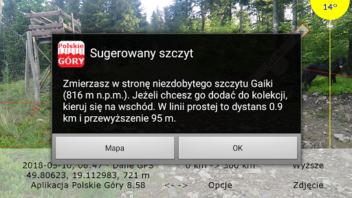
Preferred peak
VFX-Effekte Video-Editor Pro-
Increasing the limit of the number of peaks in the band to 666, adding peaks in the Sudetes and in the Western Beskids
Addition of peaks in the Western Beskids and in the Makowski Beskids
Adding peaks in the Beskid Mały, improving the direction of the shadow cast
Adding peaks in the Tatras
Supplementing the base of peaks, mainly in the Slovak West Tatras
Supplementing the base of peaks, mainly in the Central Sudetes
Addition of peaks in the Western Beskids, mainly on the border of the Silesian and Żywiecki Beskids
Suggesting peaks to conquer, doubling the number of peaks in the Beskid Niski, rounding the distance
Hiding the shapes of mountains hiding behind the horizon
Cosmetic changes in the base of peaks, extension of descriptions of selected mountain groups
Change in the location of Bajków Groń in Pieniny
Updated assignment of peaks to bands, mainly Pogórze Spisko-Gubałowskie
Small corrections in the algorithm for determining the visibility of peaks, changing the description of Barania Góra
Drawing a border on the map
Supplementing the base of the peaks - mainly the Slovak Pieniny
Selecting the City of Poland band for the northern part of the country, drawing panoramas even in the absence of visible mountains, limiting the number of frames reading the horizon from the image
Adding peaks near High in the Tatras
Compass error repair on Asus ZenFone 3 Max, repairing image reading error on Samsung Galaxy S5
Update of peaks in the Beskid Mały
Information on horizon recognition, previous information cleaning about the nearest summit
Displaying a friendly location name instead of coordinates
Syhlec in the Beskid Żywiecki
Additional graphics in the application help, handling a rare error when running the application during its update
GPS navigation - updating the view when changing the viewing direction, without changing the position
Recognition of the horizon line, GPS navigation, updating the base of peaks in the Western Beskids
Correction of the Kalenica name in the Sowie Mountains
Correcting a problem with a compass (negative value of System.currentTimeMillis ())
Improvement of the location of the peaks near Morskie Oko
Small corrections on the list of peaks in the Tatras - Walentkowy and Gładki Wierch as border peaks (without SK)
Additional information on distance to the top, Google altitude correction for coastal objects
Return to the red shapes of the mountains, information on the number of peaks: all, visible, described
Adding peaks in the bands around the Tatra Mountains
Addition of peaks in the Silesian-Moravian Beskids
Addition of peaks in the Silesian Beskids near Barania Góra
Maintaining a fixed line length of descriptions when changing position, persistence of camera resolution settings after locking the settings screen
No distance limit for the City of Poland bandwidth (problem when changing position)
Adding peaks in Gorce
Adding peaks in Stołowe Mountains, the fourth question at the first launch of the application

 Samsung Galaxy Tab E

